UN
14 Drovers Way
£ 350,000
Description
We don't have a Description for this property.
- Bedrooms
- 4
- Bathrooms
- 0
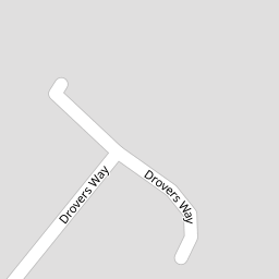


Leaflet © OpenStreetMap contributors
The heatmap indicates the level of crime in the area. The color of the heatmap indicates the crime severity and recency.
Metrics Year-on-Year
- Average area value
- 761,083.00 £Increased by 6.90 %
- Average area rental value
- 2,056.00 £/moDecreased by 3.34 %
- Est rental Yield
- 3.24 %Decreased by 9.75 %
- Crime Rate
- 19.00 %Unchanged by 0.00 %
from 711,963.00 £
from 2,127.00 £/mo
from 3.59 %
from 19.00 %
Nearby Schools
| Name | Type | Ofsted | Distance |
|---|---|---|---|
| St Philip Howard Catholic School | Academy Converter | Outstanding | 0.35 KM |
| Barnham Primary School | Academy Converter | Good | 0.38 KM |
| Eastergate Cofe Primary School | Voluntary Controlled School | Good | 1.89 KM |
| Ormiston Six Villages Academy | Academy Sponsor Led | Good | 2.17 KM |
| The Amicus School | Other Independent Special School | Good | 2.39 KM |
Images
Nearby Streets
| Name | Average Price | Average Sqft | Distance |
|---|---|---|---|
| Nursery Close | £ 0 | 0 | 0.00 KM |
| Marshall Close | £ 350,000 | 0 | 0.00 KM |
| Freeman Close | £ 0 | 0 | 0.00 KM |
| Canal Mews | £ 0 | 0 | 0.00 KM |
| Cob Lane | £ 0 | 0 | 0.00 KM |
Nearby Transport
| Name | NLC | TLC | Distance |
|---|---|---|---|
| Barnham | 5252 | BAA | 0.87 KM |
| Bognor Regis | 5253 | BOG | 6.57 KM |
| Ford | 5258 | FOD | 7.39 KM |
Nearby Listings
| Address | Price | Type | Score | Distance |
|---|---|---|---|---|
| Drovers Way, Barnham | £ 595,000 | BUY | 7 / 10 | 0.01 KM |
| Drovers Way, Barnham | £ 360,000 | BUY | 6 / 10 | 0.05 KM |
| Elm Grove, Barnham | £ 550,000 | BUY | Unknown | 0.12 KM |
| Elm Grove, Barnham | £ 750,000 | BUY | 6 / 10 | 0.14 KM |
| Elm Grove, (Private Road) Barnham | £ 799,950 | BUY | 7 / 10 | 0.20 KM |
Nearby Properties
| Address | Price | Distance |
|---|---|---|
| 10 Drovers Way | £ 435,000 | 0.00 KM |
| 6 Drovers Way | £ 350,000 | 0.00 KM |
| 9 Drovers Way | £ 460,000 | 0.00 KM |
| 2 Drovers Way | £ 390,000 | 0.00 KM |
| 14 Drovers Way | £ 350,000 | 0.00 KM |